The Architect of the Blue Homeland Speaks
Admiral Cihat Yaycı’s 22-Year Struggle to Define Türkiye's Maritime Destiny
- May 20
From a colonel’s vision to national legislation - the inside story of the doctrine, the map, the Libya Agreement, and the law that will shape Türkiye’s future at sea
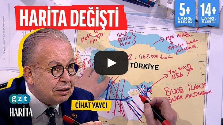
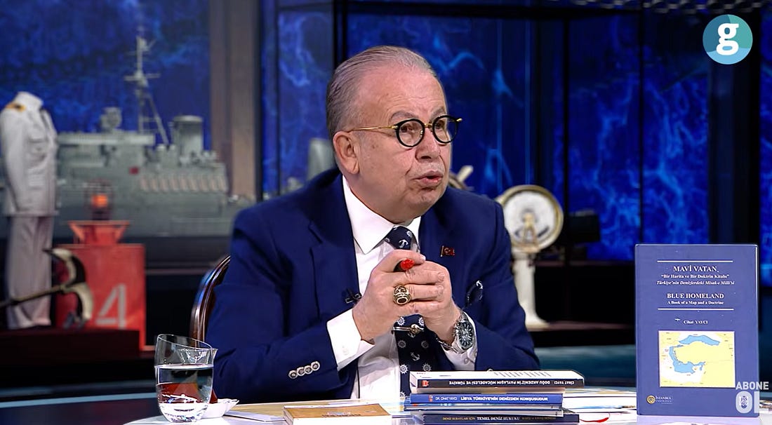
Retired Rear Admiral Prof. Dr. Cihat Yaycı talking on GZT news reveals the origins of the Mavi Vatan - Blue Homeland to viewers. Image Source: (Screenshot) YouTube | GZT News | Warning from Admiral Cihat Yaycı on the “Blue Homeland”: What Happens Now?
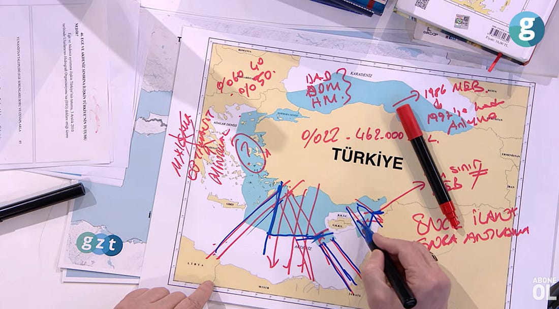
Cihat Yaycı lays the key maps on the table and annotates details: the meanings, implications and challenges. Image Source: (Screenshot) YouTube | GZT News | Warning from Admiral Cihat Yaycı on the “Blue Homeland”: What Happens Now?
Map of the Mavi Vatan doctrine by Cihat Yaycı. Image Source: Wikipedia
Introduction: The Man Behind the Map
There is a map. It hangs on walls in naval headquarters, appears in academic journals, and has been debated in parliaments. It is called the Blue Homeland (Mavi Vatan). And for twenty-two years, one man has been its architect, its defender, and its living embodiment.
Retired Rear Admiral Prof. Dr. Cihat Yaycı is not a politician. He is not a pundit. He is a naval officer turned academic - a man who commands three distinct and rare competencies: he understands cartography, he knows the sea firsthand from decades of naval service, and he is an academic in international relations and maritime law.
In a recent interview with GZT News, standing before the map he drew over twenty-two years, Yaycı did something remarkable. He laid bare the entire history of the Blue Homeland doctrine - its origin, its legal foundations, its strategic phasing, the opposition he faced, and its final transformation into national legislation.
This is not a story of slogans. It is a story of science, strategy, and persistence.
The Origin Story - From Colonel to Academic
The Blue Homeland was not born in a political rally. It was born in academic books.
Yaycı’s journey began while he was still on active duty, when he wrote “Basic Maritime Law” together with Ali Kurumahmut. This was not a popular publication. It was a methodology - a systematic attempt to explain the concepts of maritime law to the Turkish Naval Forces.
“First, we tried to explain the concepts of Basic Maritime Law to the Turkish Naval Forces,” Yaycı says. “In short, for Turkish naval officers.”
Then came another book: “What Is and Is Not an Exclusive Economic Zone? Questions and Answers.” And with it, the first iteration of a map.
“This Blue Homeland map is actually my map,” Yaycı states flatly. “I wrote the Blue Homeland Doctrine. It was published by Istanbul University as an international academic book. I drew this map; it took me 22 years.”
What makes Yaycı uniquely qualified for this work is the convergence of three disciplines. “I understand cartography,” he explains. “I understand the military. I know the sea firsthand. And I am an academic in international relations. When all of these came together, these works emerged.”
He is careful to distinguish his work from those who would claim expertise without credentials. “Now, individuals who cannot even mark a latitude and longitude on a map - academics - attempt to draw maps. Those who cannot even mark a latitude and longitude on a map attempt to produce ideas about Türkiye’s future. It cannot be done. Not everyone can do this work.”
He corrects his critics and lays his credentials. “This is not arrogance at all. Moreover, this is not something that any naval officer could accomplish. My advantage was that I was both a naval officer and an academic. And that I had devoted immense effort to this field.”
The Legal Foundation - 22 Years of Case Law
The Blue Homeland is not a political slogan. It is a legal argument - and Yaycı spent twenty-two years building it. Twenty-two years.
“I examined all the decisions,” he says. “Every single one of them. The decisions of the International Court of Justice, the International Maritime Courts, and arbitration tribunals.”
The legal framework of the Blue Homeland rests on the United Nations Convention on the Law of the Sea (UNCLOS), which states that maritime jurisdiction areas should be divided equitably. But equity, as Yaycı explains, is not a blank check. “Where do the other principles come from? They emerge from the decisions of the International Court of Justice, the International Maritime Courts, and arbitration tribunals.”
He read every case. Every judgment. Every arbitration. And from that exhaustive study, he drew the map.
“That is why I say it took me 22 years,” he says. “Therefore, for people to speak about the Blue Homeland without knowing its legal framework, without even examining its cases, without understanding what it means, and without knowing how maritime delimitation is carried out - it harms Türkiye’s interests. Let them speak. But let them not damage Türkiye’s interests.”
The Two Maps - A Phased Strategy
One of the most revealing moments in the interview comes when Yaycı explains why there are two maps - and why most people have misunderstood them.
“Look, do you see these two maps here? There is a difference between these two maps. Others think there are two maps - one drawn by Cihat Yaycı and another by someone else. No, both of them are my maps.”
The area of both maps is the same: 462,000 square kilometers. But the first map does not show certain areas. The second map does.
“Why did I not show these places on the first map?” Yaycı asks. “Because my entire objective at first was for the Libya Agreement to be signed. Once the Libya Agreement was signed, Egypt was already there. Since we have opposite coastlines with Palestine, Israel, Lebanon, and Syria, I said that afterward I would produce a new map and revise the map.”
This is strategy. Phased. Deliberate. Intelligent in design. The first map was designed to achieve a specific political objective: the Libya Agreement. The second map would reveal the full extent of Türkiye’s maritime rights.
“Those who truly understand this matter realized that the figure of 462 thousand square kilometers does not emerge from my first map,” Yaycı says. “But in my second map, it reaches 462 thousand square kilometers.”
The Libya Agreement - A Decade of Struggle
The Türkiye-Libya Memorandum of Understanding (MOU) on Maritime Jurisdiction, signed in 2019, was a diplomatic earthquake. It broke the Greek-Israeli attempt to encircle Türkiye in the Eastern Mediterranean. But few know the story of how it came to be - and how long Yaycı had been advocating for it.
“My work on this began in 2009,” Yaycı reveals. “I wrote my first academic article under the title ‘The Role of Libya in Determining the Turkish Maritime Jurisdiction Area.’”
President Erdoğan, then Prime Minister, saw the importance of the idea. “He went to Gaddafi. I am speaking of the year 2010. President Erdoğan explained it to Gaddafi while standing before the map. They reached an understanding with Gaddafi to make an agreement. Everyone instructed their respective teams.”
Then, three months later, Gaddafi was gone. The agreement was postponed for nearly a decade.
But Yaycı did not stop. “I kept refining this issue over and over again and brought it forward. I constantly kept this matter on the agenda within the Naval Forces. I wrote and spoke about it everywhere.”
The struggle was not only external. It was internal. “We had bureaucrats and academics who opposed the Libya Agreement,” Yaycı says. “Those who could not comprehend or see how we could possibly have opposite coastlines with Libya.”
The problem, Yaycı explains, was a fundamental failure of perspective. “Our academics and bureaucrats view it as though Türkiye lies perfectly flat from east to west on a sheet of paper. However, the world is curved. Türkiye lies at a 22 percent angle on the globe.”
He challenged his opponents directly. “I said, ‘My friends, how could such a thing be possible? How could this be? Do you not believe me? Then look - the Greek Cypriot administration of southern Cyprus has declared an Exclusive Economic Zone. A full 360 degrees. With Egypt. With Israel. With Lebanon. They attempt to do the same with Greece. Do you see the angles?”
It took ten years to explain the Libya Agreement. “We struggled for ten years,” Yaycı says. “I struggled immensely to explain it.”
The Concession - Why the Blue Homeland Is Not Maximalist
Critics of the Blue Homeland often call it “maximalist” or “expansionist.” Yaycı rejects this framing - and he has the numbers to prove it.
“In the Sea of Islands, our Exclusive Economic Zone is not defined,” he explains. “We have not declared it. We advocate equal sharing, the median-line principle of division. However, in reality, the coastline length of our mainland is greater than that of mainland Greece. According to the principle of proportionality, we should receive 60 percent and Greece 40 percent.”
But that is not what Yaycı drew.
“When I drew this map, I genuinely made it 50–50 with Greece. In fact, that was a concession. We effectively made a 20 percent concession. Because if it should be 60 percent, then compared to 50 percent, that constitutes a 20 percent difference.”
He is emphatic: “This map is not maximalist. Nor is it optimalist. It lies somewhere between minimalist and optimalist.”
He also rejects any association with neo-Ottomanism or imperialism. “Some people say this has something to do with Neo-Ottomanism. It has nothing to do with that. It has nothing to do with imperialism either. This Blue Homeland doctrine concerns maritime jurisdiction areas. It is the doctrine of how our seas within maritime jurisdiction areas will be used, protected, benefited from, and how our rights will be expanded.”
The Sea of Islands - Linguistic Decolonization
One of Yaycı’s most significant contributions may be linguistic. He has championed the replacement of the term “Aegean Sea” with “Sea of Islands” (Adalar Denizi).
“The term Sea of Islands is a term used by our ancestors,” Yaycı explains. “At the same time, our ancestors also referred to the Aral Sea as the Sea of Islands. We turned Ceyhun into the Ceyhan River, Seyhun into the Seyhan River, and we also brought the term Sea of Islands from the Aral region to the sea now called the Aegean.”
This is not mere semantics. It has strategic implications.
“The line between the Sea of Islands and the Mediterranean should pass from the southernmost part of all the islands, not through the middle,” Yaycı argues. “Because if it passes through the middle, Greece will say, ‘This side of mine remains within the Sea of Islands. I will apply 6 nautical miles here and 12 nautical miles below it.’”
The result would be catastrophic: Greek territorial waters would close critical passages. “If Greece extends to 12 nautical miles in the Mediterranean, these passages become closed. Whereas normally these areas remain open. In order for these to remain open, this boundary must be drawn further south.”
Yaycı issued a direct call to the relevant authorities: “The relevant authorities should definitely hear this and renew this position before the International Hydrographic Organization.”
The Opposition - Fighting Bureaucrats and Academics
Yaycı’s path was not smooth. He faced opposition from within Türkiye’s own bureaucracy and academy.
“Some people now say, ‘These admirals and generals only start talking after retirement.’ Nonsense,” Yaycı says. “I wrote 80 percent of these books while I was still on active duty.”
His work attracted attention - and not the friendly kind. “Because I wrote this book – the book ‘Greek Demands’ – Greece filed complaints against me. All of these books of mine were featured on the front page of E-Kathimerini while I was still serving. Full page headlines. ‘This man is trouble. He is damaging Turkish-Greek relations,’ they said. I experienced all of this.”
He is careful to distinguish between the Greek state and Greek citizens. “I have no problem whatsoever with Greek citizens. My issue is with the unfriendly state policy of Greece. Otherwise, we could live here in friendship. Türkiye does not have Greece as a target anyway. But Greece constantly demands something from Türkiye.”
The book is titled “Greek Demands” for a reason. “Greece is the one demanding territorial waters. Is Türkiye the one demanding expansion? Is Türkiye the one demanding expanded airspace? Or who is demanding that the Sea of Islands become a Greek lake? Are we saying it should become a Turkish lake? No, we are saying it should be shared.”
The Open Challenge
Near the end of the interview, Yaycı issues an open challenge to his critics.
“Now someone comes out and says something. Not every admiral or officer understands this matter. I openly challenge them. Let someone who can prove otherwise come forward - someone who has written books on maritime law, drawn maps, claimed ownership of such work. Let not just any random person come forward claiming to be an expert.”
He is specific about the credentials required. “If there is anyone who truly says, ‘I know this subject, I am qualified, and I assert expertise’ - someone with books on the matter, someone who says, ‘I am also part of the Blue Homeland’ - let them come. I am open to debate anywhere.”
And then, three times in succession, he repeats the invitation: “We invite them to the map. We invite them to the map. We invite them to the map. This is a very important matter.”
It is a dare. But it is also a statement of supreme confidence. Yaycı knows the map. He drew it. He spent twenty-two years studying every case, every judgment, every arbitration. He is inviting his critics to meet him on the terrain where he is undisputed master.
The Law - From Doctrine to Legislation
The Blue Homeland Doctrine is no longer just a book or a map. It is becoming law.
“Preparations for this law began while I was still on active duty, when I was a colonel,” Yaycı reveals. “We worked extensively on this law. The Naval Forces worked very hard. The General Staff worked very hard. The Ministry of National Defense, the Ministry of Foreign Affairs, the Ministry of Energy - everyone worked on it.”
The law addresses a critical deficiency. “Our greatest deficiency was the lack of clarity regarding what we would do in our maritime jurisdiction areas. Responsibilities were not clearly defined. Even if we declared an Exclusive Economic Zone, we had no law governing it.”
Yaycı initially expressed disappointment that he was not consulted on the draft. But when he raised the issue, he received a response that validated his life’s work.
“They said: ‘We had all your books, your entire doctrine, and your archived speeches compiled, and we incorporated all of them into the law. We also included the name “Blue Homeland” in this law, Admiral.’”
He was pleased. “I was very pleased about that.”
He is also careful to acknowledge the contributions of others. “I would like to sincerely thank everyone who contributed to this law. Because this is a new milestone for Türkiye. It remedies a very important deficiency. This has been a very long process – at least 15 to 16 years of work.”
The Doctrine in Practice - What Changes with the Law
What will the Blue Homeland Law actually do?
Yaycı explains that the law clarifies Türkiye’s position on several critical issues. First, it will define what Türkiye will do in the Sea of Islands. “What will happen there? How will this area be protected? What will be done if there is a violation? Who will be granted fishing licenses?”
Second, it will enable Türkiye to declare an Exclusive Economic Zone in the Eastern Mediterranean. “In the Black Sea, we declared an Exclusive Economic Zone in 1986. First declaration, then agreement. Some people say, ‘Let us first reach an agreement.’ No, there is no such thing as ‘agreement first.’ First declare it, present your map, then you reach an agreement.”
The rump Greek Cypriot administration did exactly this, Yaycı notes. “The Greek Cypriot administration of southern Cyprus first declared it in 2003. Four years later, they signed an agreement with Lebanon. Seven years later, in 2010, they signed an agreement with Israel. When the agreement with Lebanon failed, in 2025 - approximately 22 years later - they implemented it in the form of a technical agreement.”
Türkiye must do the same. “Therefore, we too must present our map.”
The law will also clarify Türkiye’s position on the distinction between the Sea of Islands and the Mediterranean. Yaycı personally wrote this position in 2011. “I had this written in Türkiye. It concerns Türkiye’s distinction between the Sea of Islands and the Mediterranean. Our position is that the line should pass from the southernmost part of all the islands, not through the middle.”
This is not a technical detail. It is a strategic imperative. It prevents Greece from extending its territorial waters to 12 nautical miles in the Mediterranean, which would close critical passages.
The Unfinished Work
The Blue Homeland Law is a milestone, but it is not the finish line. Yaycı identifies several areas where work remains.
First, Türkiye has not yet declared an Exclusive Economic Zone in the Eastern Mediterranean. “Turkey has at times declared continental shelf boundaries. For example, before the Libya Agreement, the area declared was this part. Then, after the Libya Agreement, this area expanded.”
Second, Türkiye must establish lateral boundaries with Syria, Lebanon, Palestine, and Israel. “Those who opposed the Libya Agreement are now also opposing the fact that we have opposite coasts with Palestine, Israel, Lebanon, and Syria. They are speaking without knowledge.”
Third, Türkiye must renew its position before the International Hydrographic Organization regarding the Sea of Islands-Mediterranean distinction. “The relevant authorities should definitely hear this and renew this position.”
Fourth, the territorial waters issue remains unresolved. “Our laws are ambiguous regarding the determination of territorial waters. Reciprocity says one thing, another provision says something else.”
The Reactive Doctrine
There is a framing of the Blue Homeland that one encounters often, especially in Greek and Western commentary. It is the framing of “aggression”: Türkiye “reaching out,” Türkiye “claiming,” Türkiye “demanding,” Türkiye “threatening,” Türkiye “attacking” international law and the maritime status quo.
This framing is historically and legally inverted.
Admiral Yaycı did not wake up one morning and decide to draw a map. He responded. He responded to Greek claims. He responded to Greek maps. He responded to a systematic, decades-long attempt to turn the Sea of Islands into a “Greek lake” and to exclude Türkiye from the Eastern Mediterranean.
The sequence is clear and documented.
Greece acted first. The rump Greek Cypriot administration of southern Cyprus declared an Exclusive Economic Zone in 2004, applied retroactively to 2003. It drew maps with Egypt, with Israel, with Lebanon. It commissioned the University of Seville to draw a map that would turn the Sea of Islands into a Greek lake and have Greece recognized as an archipelagic state.
Yaycı describes this explicitly: “The issue of the Greek and Greek Cypriot duo commissioning the University of Seville - I call them the ‘little brothers-in-law’ - finding a university in Seville, Spain, and having this map drawn there. So that they could say, ‘A Spanish university drew it, it has nothing to do with us.’”
This was the provocation. The Blue Homeland was the response.
Yaycı did not invent claims to Greek territory. He did not draw maps that would expel Greeks from their islands. He did not demand that the Sea of Islands become a “Turkish lake.” On the contrary, he drew a map that shares the sea equitably.
“Are we saying it should become a Turkish lake?” Yaycı asks rhetorically. “No, we are saying it should be shared.”
As he would also concede on other programs, Türkiye has a crucial shortcoming - it is always the reactive defender. It needs to start taking the initiative - not reacting, not defending - but actively creating the conditions to defend its own national security. Yaycı acknowledges this frankly
Conclusion: The National Pact at Sea
Yaycı frames the Blue Homeland as a continuation of Türkiye’s National Pact (Misak-ı Milli) - but applied to the sea.
Just as the National Pact defined Türkiye’s land borders and national compact, the Blue Homeland defines Türkiye’s maritime rights. It is not a doctrine of aggression. It is a doctrine of rights. It is not expansionist. It is equitable. It is not political. It is legal, scientific, and technical.
“Its legal infrastructure and technical infrastructure were established over a very long-term study,” Yaycı says. The evidence is in the books he wrote, the maps he drew, the cases he studied.
Some people now claim that the Blue Homeland is a slogan. They could not be more wrong. It is a 22-year academic and strategic project, finally being translated into national legislation.
“This law remedies a very important deficiency,” Yaycı says. “This is a new milestone for Türkiye.”
And the man who drew the first map, who wrote the first book, who spent twenty-two years studying every international maritime case, who struggled for a decade to explain the Libya Agreement, who faced opposition from bureaucrats and academics and complaints from Greece - that man is still standing before the map, still inviting his critics to debate, still defending the doctrine that he alone authored.
“I openly challenge them. Let someone who can prove otherwise come forward. We invite them to the map. We invite them to the map. We invite them to the map.”
The map is drawn. The doctrine is written. The law is coming.
The Blue Homeland is no longer just an idea. It is Türkiye’s maritime destiny.
This article is based on the GZT News interview with Retired Rear Admiral Prof. Dr. Cihat Yaycı, Faculty Member at Topkapı University. The full interview is available on GZT's YouTube channel .
My name is Mustafa Niyazi, and I connect the disconnected

The value of truth is measured by the cost of ignoring it.
My name is Mustafa Niyazi, and I connect the disconnected.

No comments:
Post a Comment